Categories
Alberta Economic Ft Mac

Athabasca River Water Usage by Energy Companies has Dropped

Athabasca River, water usage by energy companies

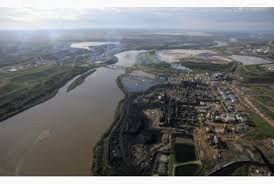
A performance update that was recently released by the Canada’s Oil Sands Innovation Alliance shows that there was a decline in the water amount needed to produce a single barrel of oil, and this decline was roughly 30% in the two year period between 2012 and 2014. In 2012 energy companies which used water from the Athabasca River required 2.2 barrels of water to produce one barrel of oil. In 2014 only 1.5 barrels of water was needed to end up with a single barrel of oil. According to John Brogly, the Water EPA director for COSIA, “It is still very early days and COSIA members expect there may be significant variation in performance from year to year.” The report released by COSIA also showed that the organization members were responsible for 37 different environmental projects covering a wide variety of environmental concerns.

In recent months there has been a lot of concern expressed about the water usage by energy companies which draw water from the Athabasca River. Earlier this year the water level of the river was low enough to be noticeable, and there were calls on monitoring water usage from the river and lowering the amount of water that companies could draw from the waterway. The recent COSIA report shows that the energy industry is trying to find ways to conserve water and lower their usage. Wood Buffalo depends on the energy industry for a thriving economy, but the environment also has to be protected in order to preserve it for future generations.
Categories
Alberta Economic Ft Mac

Water Level of Athabasca River Impacting Local Residents and Wildlife in the Area

Athabasca River, water level

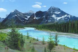
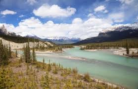
The water level for the Athabasca River is low, and that is having an impact on the local residents and the wildlife in the area. Historical records for low water levels in the Peace Athabasca Delta are being broken this year and that is a big cause for concern. As the largest inland freshwater delta in the world the water level is a big factor for locals. The Athabsaca River is fed by meltwater and glacier runoff from the Rocky Mountains as well as local tributaries. Alberta Environment spokesperson Lisa Glover explained “The main reason for low flows now at this point of year is that there hasn’t been any precipitation.” The low level of water has caused hardships for the population and the wildlife in the area because food supply, transportation, and water availability for local wildlife are all impacted.

The low water level of the Athabasca River has created problems for people who depend on the waterway. Using a boat to travel by river is not safe because of the water level, and boaters could cause damage to the boat or even smash a motor if they hit an unseen sandbar. According to Mikisew Cree band councillor Ronnie Campbell residents from Fort Chipewyan can not travel to Fort MacMurray for groceries and other essential supplies. Campbell said “They get discouraged. So they’re forced to buy groceries from our Northern Store, where the prices are ridiculously high.” Another issue is that traditional hunting and fishing grounds are not accessible right now because the water is too low.

Categories
Alberta Ft Mac

The Athabasca River Ice Breakup is Over

Athabasca River, ice breakup

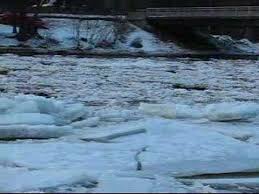
Wood Buffalo residents can utter a sigh of relief now that the Athabasca River ice breakup is officially over. The municipality made it official by announcing that the river breakup is finished and the flooding threat from the ice is no longer a concern. For a week before the event ended there was ice that was located in the municipality which had stopped. This final threat was lifted once the ice in the area flowed away to the north of Fort MacMurray. Long time local residents are accustomed to the yearly river breakup and the possibility that stopped ice in the area could cause flooding during this time of year. Some areas of Fort MacMurray have ended up under water during the Spring ice flows on the Athabasca River in past years so this year was a good one.

Just because the Athabasca River ice breakup is over this does not mean that municipal authorities will stop monitoring the condition of the river. The municipality is warning residents that the shorelines and banks of the river may still be dangerous because of ice which has accumulated in these areas. Until 1 p.m. last Tuesday there was ice which was stopped in Wood Buffalo, but the ice that was jammed up near the Clearwater River entrance worked its way through and is no longer in Wood Buffalo. Spring time in Fort MacMurray and the surrounding region can be beautiful and dangerous both. Residents need to be prepared during this time of year and watch for any hazards.

Categories
Economic Ft Mac Health

Water Levels Rise as Athabasca River Breaks

Athabasca River, water levels

The Athabasca River has started to break, and this has led municipal authorities to urge caution as the water levels rise in some areas. Monitoring staff has been deployed to keep close watch on the water levels and river condition. Assistant deputy chief of emergency management Alan McIntosh said “We had about a three hour ice run that moved through the municipality, but didn’t keep going. Since that period, we’ve had some water rises in different places … It’s caused a little bit of water backup in the Snye and around the very very low-level areas in Waterways.” As the ice breaks up on the river and the warmer temperatures cause thawing and melting some parts of Wood Buffalo could get wet very quickly.

The rising water levels of the Athabasca River are unpredictable, and McIntosh warns that it is very difficult to forecast how the break up of the river will progress. “There’s no magical formula. My hope is that … we’ll get enough push from the water coming down from (upstream) that will push the ice through and let all the water out of the Clearwater. Worst case scenario, we get a jam and the water could come up further.” The river breakup will not be declared complete, and monitoring will not stop, until all of the ice has cleared the area and there is no longer any flooding risk from potential dams that could stop the flow of the ice. McIntosh warned residents to be cautious right now. “We can’t say enough to stay away from the banks, they’re really slippery. We’re on watch right now to see what we can … everyone’s doing their job.”