Bundle up. A section of Alberta is going to get buried, and fast.
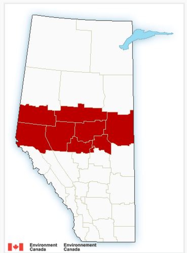
Environment Canada issued a snowfall warning Monday morning for a large swath of the province, as a low pressure system is expected to wallop a portion of the province with a winter storm.
The system is expected to move across a band of Alberta, from B.C. to Saskatchewan, dumping 10 to 15 centimetres of snow in a 12 hour period between Monday afternoon and Tuesday morning.
The warning stretches from Hinton and Grande Prairie in the west, across to the Cold Lake region in the east, and includes the city of Edmonton and surrounding areas.
The snow is forecast to begin late Monday afternoon and then track eastward through the Edmonton region overnight, before exiting the province Tuesday afternoon.
“Snowfall totals are expected to be in the 10 to 20 centimetre range by the time the system tracks into Saskatchewan on Tuesday,” reads the advisory.
The rapidly accumulating snow could make travel on highways and city roads difficult cautioned Environment Canada, and there may be a “significant impact” on rush hour traffic in urban areas.
By Tuesday morning, the following communities could see up to 15 centimetres of snow:
- Bonnyville
- St. Paul
- Cold Lake
- Lac La Biche
- Edmonton
- St. Albert
- Sherwood Park
- Fort Saskatchewan
- Vegreville
- Redwater
- Smoky Lake
- Grande Prairie
- Beaverlodge
- Valleyview
- Hinton
- Grande Cache
- Slave Lake
- Spruce Grove
- Morinville
- Mayerthorpe
- Evansburg
- Westlock
- Barrhead
- Athabasca
- Whitecourt
- Edson
- Fox Creek
- Swan Hills
If it’s safe to do so, share your winter storm photos with the CBC Edmonton Facebook page.