Why Nova Scotia could be in the path of a future tsunami

Ninety years after the deadliest earthquake in Canadian history struck the North Atlantic, researchers have found evidence that the region is more vulnerable than they first thought.
The lower part of the Scotian Slope, southwest of Nova Scotia, experiences massive underwater landslides at a rate 10 times higher than initially believed, according to a recent study published in Geology.
They’re happening about once every 1,000 years, instead of once of every 10,000 years, the study found.
This may represent “a significantly underestimated hazard along the western North Atlantic,” the authors wrote.
The researchers uncovered remnants of four underwater landslides in the past 4,000 years on the scale of the 1929 Grand Banks earthquake that led to the death of 28 people along the Burin Peninsula in Newfoundland.
“Not only did they potentially cause tsunamis, they also damaged the infrastructure on the seabed, such as submarine cables,” Calvin Campbell, a marine geologist with the Geological Survey of Canada, told CBC’s Mainstreet recently.
While smaller landslides have been recorded near the Scotian Slope, until now it was believed the 1929 quake was the only such event of its size in recent history.
Campbell was among a team of researchers who stumbled on this realization while doing research off the coast of Newfoundland and Nova Scotia in 2012.

By chance, the team discovered a submarine landslide deposit three times the size of Prince Edward Island. It looked remarkably like the sea floor after the 1929 earthquake — only bigger.
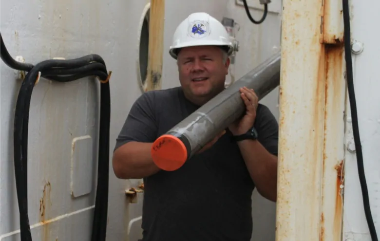
Researchers wanted a closer look, so they used a device called a piston core to collect sediment some 5,000 metres below the water’s surface.
The samples they pulled up showed the landslide happened about 1,500 years ago.
90th anniversary of tsunami
Landslides at the bottom of the sea can create huge ripple effects above the water. That’s what happened on Nov. 18, 1929 when an earthquake struck the Continental Slope about 250 kilometres south of Newfoundland.
Monday marks the 90th anniversary of the tsunami that killed 28 people and injured hundreds more.

Campbell said the Continental Slope is steep— “try walking from the top of Citadel Hill down to the waterfront and that gives you an idea of the gradients” — and it’s covered in mud.
So when the earthquake struck, all that mud collapsed, pushing water out if its way.
Two and a half hours later, people saw the harbours empty near the communities along the Burin Peninsula.
“That sort of effect is a common effect associated with tsunamis,” Campbell said. “The water was drawn away and then this wall of water came in.”
Campbell said the 1929 Grand Banks earthquake proved that these events don’t just happen on the West Coast.
“The 1929 event is the most documented casualties due to an earthquake in Canada,” he said.
Along with dating the landslides, researchers also took samples to see how stable the seabed is today.
“Happy to say that based on the samples we have, the seabed is what we call statically stable,” Campbell said. “It doesn’t appear to be currently in a state to collapse, and you’d need an external trigger like a large earthquake to cause one of these events.”
But that doesn’t mean Nova Scotia is out of the woods, he added.
Happy to say that based on the samples we have, the seabed is what we call statically stable.– Calvin Campbell, Geological Survey of Canada
There are “several smoking guns” that could point to a tsunami heading toward Nova Scotia, Campbell said. But they are more likely to originate in the Puerto Rico trench or north of the Caribbean where there are significant earthquakes.
The study concludes that it’s hard to know whether the underwater landslides discovered in the North Atlantic would have triggered tsunamis.
“But the potential threat to coastal communities of eastern North America should not be discounted,” the report said.
MORE TOP STORIES


